The Pennine climate around Bradford saturates the upper soil layers for most of the year, so any excavation deeper than one metre quickly encounters perched water tables and softened glacial till. That kind of ground behaviour demands continuous geotechnical excavation monitoring that tracks pore pressure changes and wall deflection in real time. Before breaking ground, we always run a [MASW survey](/masw-vs30/) to map stiffness contrasts across the site, because the variability of the underlying Millstone Grit sandstone can catch contractors off guard. Paired with standpipe piezometers and inclinometer casings, the monitoring setup gives early warning of seepage zones and potential basal heave, especially on sloping plots near the city centre.
Real-time inclinometer readings in Bradford's glacial till often show accelerating creep within two hours of a rain event, well before surface cracks appear.
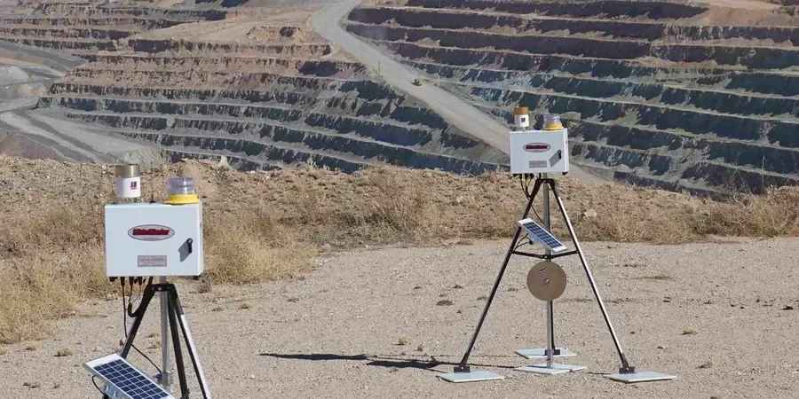
Method and coverage
Regional considerations
A six-storey development off Manchester Road recently hit a buried sandstone pinnacle during secant pile installation. The rig started chattering and the adjacent gauge showed sudden eastward deflection of 8 mm in one shift. Without automated geotechnical excavation monitoring, that drift would have been missed until the next daily walk-around. The team installed a second inclinometer on the opposite side and slowed the excavation sequence, using the real-time data to adjust the tie-back stressing loads. That kind of scenario is exactly why we insist on threshold alarms tied to a 24/7 monitoring centre.
Standards that apply
BS EN 1997-1:2004 (Eurocode 7 – Geotechnical Design), BS 5930:2015 (Code of Practice for Ground Investigations), CIRIA C760 (Guidance on Embedded Retaining Walls), NHBC Standards Chapter 4.2 (Building near trees, relevant for Bradford clay sites)
Complementary services
Instrumentation installation and baseline survey
Inclinometer casings, standpipe and vibrating-wire piezometers, settlement studs, and crack gauges installed before excavation begins. All instruments are surveyed to establish a reliable baseline, with readings taken every 12 hours for the first week to capture diurnal temperature effects.
Real-time data management and alarm response
Automated data loggers transmit readings to a secure cloud platform every 15 minutes. Engineers set amber and red thresholds based on the method statement, and the system sends SMS alerts when movements exceed 50% of the design limit. Weekly reports include trend graphs and comparison with the original FEM model.
This service complements our laboratory testing work for a complete project analysis.
Typical parameters
Top questions
What is the difference between manual and automated geotechnical excavation monitoring?
Manual monitoring relies on periodic readings taken by a technician with a portable inclinometer or theodolite, typically once or twice per day. Automated systems use in-place inclinometers, vibrating-wire sensors, and robotic total stations that log data continuously. For Bradford's variable ground conditions, automated systems detect sudden movement (e.g., a 3 mm shift in two hours) that a daily walk-around would miss, reducing the risk of unplanned collapse.
How much does geotechnical excavation monitoring cost in Bradford?
A typical monitoring package for a medium-depth excavation (6–10 m deep) in Bradford costs between £710 and £1,850 per week. This includes installation of 4–6 inclinometers, 3–5 piezometers, settlement markers, and daily data review. The final price depends on instrument density, site access constraints, and whether you need 24/7 alarm response. Contact us for a project-specific quote.
Which British standards apply to excavation monitoring in the UK?
The primary standard is BS EN 1997-1:2004 (Eurocode 7), supported by BS 5930:2015 for ground investigation procedures. For embedded retaining walls, CIRIA C760 provides detailed guidance on monitoring frequency and trigger levels. Local Bradford conditions also require compliance with NHBC Standards Chapter 4.2 when excavations are within root zones of protected trees.
What instrument is best for detecting lateral wall movement in Bradford clay?
In-place inclinometers with MEMS sensors are the most reliable choice for stiff glacial till and laminated clay sequences found beneath Bradford. They provide continuous profiles at 0.5 m intervals and detect rotations as small as 0.01 degrees. For very deep excavations (>15 m), we recommend adding shape-accel arrays (SAA) that give 3D displacement vectors without requiring a surveyor.
When should monitoring start relative to the excavation sequence?
Monitoring should begin at least two weeks before excavation to establish baseline readings and check instrument stability. This is especially important in Bradford where seasonal moisture changes in the till can cause apparent drift in inclinometer data. Starting early allows the team to differentiate natural ground movement from excavation-induced displacement, avoiding false alarms during the first lift.